Course Maps and Elevation Charts
Interactive Course Map - Short Course
This map is optimized for desktop and/or laptop viewing.
Route map for Dirty Kiln 10K - CLOCKWISE by
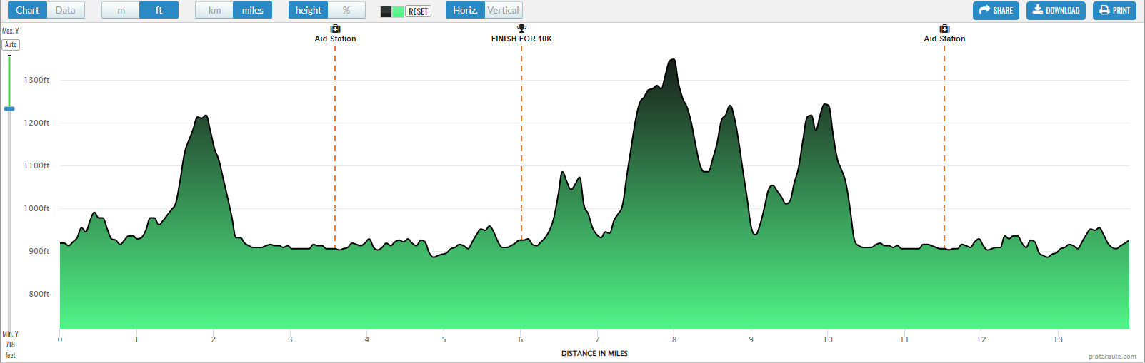
Interactive Course Map - Long Course
This map is optimized for desktop and/or laptop viewing.
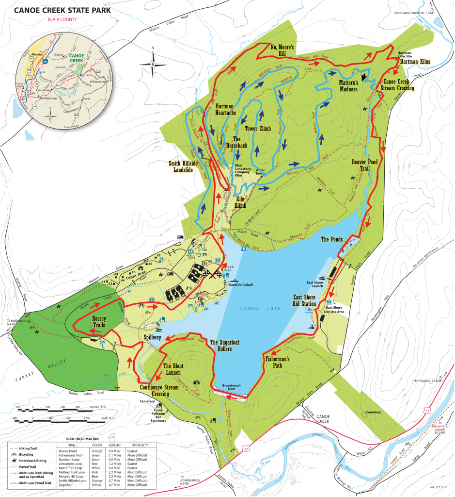
Traditional Course Map
Red: The red course is the short course which all runners will do.
Blue: The blue course is the additional mileage for the long course runners do a second loop. They will depart the previous course at the Canoe Creek Stream Crossing.